Meteorological Service Suriname | Ministry of Public Works and Spatial Planning
National Meteorological Centre | J.A. Pengel International Airport
National Meteorological Centre | J.A. Pengel International Airport
WEATHER BULLETIN FOR SHIPS
SURINAME COAST & THE GUIANAS | 05N–15N / 45W–60W
Valid: 1200UTC October 01, 2026 — 1200UTC October 02, 2026Issued by: N.M.C. Suriname
✅ NO ACTIVE WARNING — No storm warning at this time
🚨 PART I: STORM WARNING
NO STORM WARNING. No storm warning is currently active for the forecast area.
🌐 PART II: SYNOPTIC OVERVIEW — Situation 1200UTC, October 01, 2026
The Intertropical Convergence Zone (ITCZ) axis is analyzed along a mean position stretching from 06°N45°W to 07°N52°W and extending toward 06°N58°W. Low-level moisture convergence along the ITCZ remains high. An active tropical wave embedded in the deep easterly flow has its axis analyzed near 52°W–54°W, moving westward at 12–15 kt. Enhanced low-level vorticity and moisture advection associated with this wave interact directly with the ITCZ band, generating enhanced deep convection, moderate-to-heavy showers, and squall lines across the central and western offshore sectors.
🌧 Saharan Dust: No significant Saharan Air Layer intrusion was identified.
⛵ PART III: WEATHER FORECAST — 1200UTC October 01, 2026 to 1200UTC October 02, 2026
Between 1200UTC October 01, 2026 and 1200UTC October 02, 2026
💨 Wind
E to ENE at 14–19 kt (Beaufort Force 4 to 5)
👁 Visibility
In general: 10+ km (5+ nm) outside precipitation | In moderate showers: 6–8 km (3–4 nm) | In heavier showers or thunderstorms: 3–6 km (2–3 nm)
🌊 Waves N of 08N
1.8 to 2.3 m over open Atlantic waters
🌀 Swell
🌊
🌊 MARINE FORECAST SURINAME COAST — South of 08N
☀️ DAYTIME | OCTOBER 01, 2026
💨Wind DirectionE to ENE, locally ESE near the coast during the afternoon sea breeze
🌬Wind Speed10–15 kt (Beaufort Force 3 to 4), backing slightly to ESE along the immediate surf zone during afternoon sea-breeze enhancement. Gust 18–22 kt in open coastal waters; 30+ kt near daytime thundershowers.
🌊Wave DirectionE to NE
📏Wave Height1.1 to 1.6 m (3.5 to 5 ft) nearshore, building to 1.8 m offshore
👁Visibility🌤
⛅WeatherVariable cloudiness with scattered morning showers, transitioning to afternoon cloud buildup with thundershowers spreading off the coastal landmass into nearshore waters.
🌙 EVENING / NIGHT | OCTOBER 01/02 October, 2026
💨Wind DirectionE to SE, becoming light and variable after midnight
🌬Wind Speed8–13 km/h (5–8 kt), gusts 16–20 km/h (08–10 kt) in isolated showers (Beaufort scale 2)
🌊Wave DirectionE to NE, small trade-wind sea under-running the residual swell
📏Wave Height1.0-1.4 m nearshore (slight); little change overnight
👁VisibilityMostly good; local patches of mist/haze possible near dawn in coastal lowlands, not a significant hazard offshore
🌙WeatherPartly cloudy to occasionally overcast with nocturnal shower bands developing along coastal low-level convergence lines.
🔭 OUTLOOK — Suriname Coast, October 02 to October 05, 2026
⛅ Weather💨 Wind
💨 WindE–ENE winds will remain moderate offshore, generally 19–30 km/h (12–16 kt), with occasional stronger pockets up to 22-26kt. Coastal winds will remain comparatively light.
🌊 WavesOffshore seas remain around 1.0–1.6 m, with NE–E swell.
Prepared by: Pancham S., Meteorologist
mds@hydromet.sr | 325206 / 325190
mds@hydromet.sr | 325206 / 325190
www.hydromet.sr
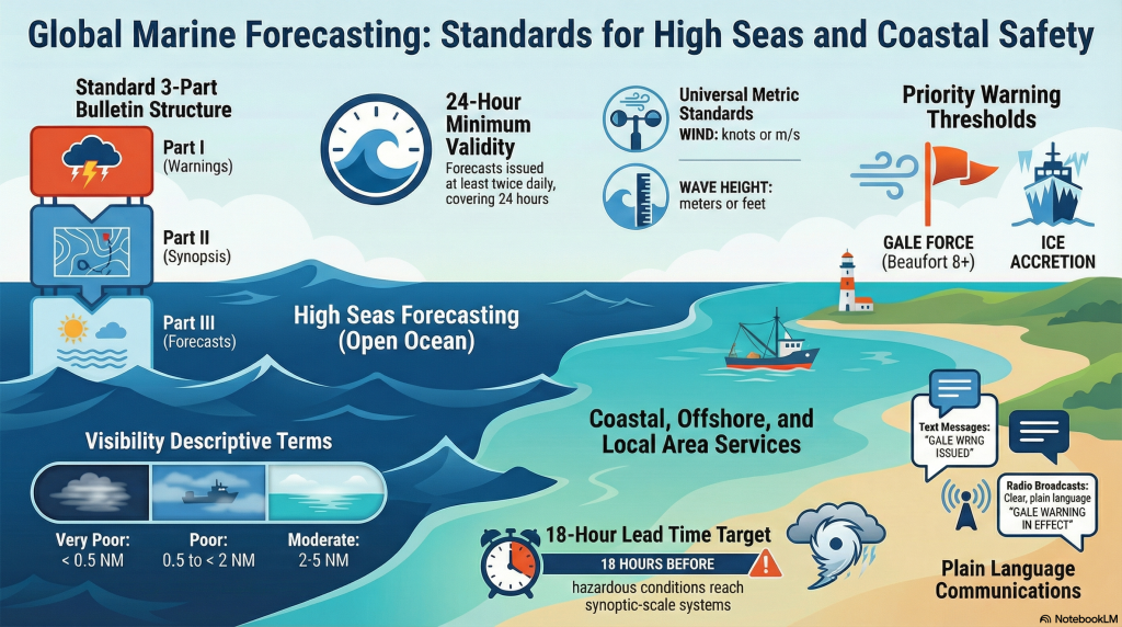
MARINE WEATHER KEY ASPECTS